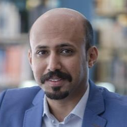


 Raid Alrowais, Ph.D. graduate from KAUST (PI: Prof. Kim Choon NG)
 Raid Alrowais will be graduating in June 2020 with a Ph.D. degree in Environmental Science and Engineering from KAUST. He obtained his Master's degree from the same Division in 2016 and his Bachelor's degree in Civil engineering from Al-Jouf University 2012. His PhD research relates to a greener and low cost seawater desalination called the direct contact spray evaporation and condensation (DCSEC).
Owing to high specific energy consumption from all practical seawater desalination methods, there is great motivation for having greener desalination processes to meet the future goals of sustainable desalination. The direct-contact spray-assisted evaporation and condensation (DCSEC) is a promising green desalination method that mitigates the issues of scaling/fouling, carbon dioxide, concentrated brine discharge and high capital cost of existing desalination plants. This study presents an experimental study on the conventional DCSEC and hybrid DCSEC with micro/nano-bubbles (M/NBs) generator device. It entails a variety of experiments with assorted seawater feed temperatures, flow rates, single and multi-stage arrangements so as to maximize the excess enthalpy of feed water for distillate production through in-situ flashing, as well as the recovery of condensation latent heat through the condenser chambers.
 Bruno Aragon, Ph.D. student (PI: Prof. Matthew McCabe)
 Bruno Aragon is a Mexican Mechatronics engineer that transitioned into the environmental engineering field. His Ph.D. work is on remote sensing of the environment for agricultural monitoring. He works with high-resolution satellite images and weather information to estimate crop water use at different scales, from a farm to a whole region. He is the co-founder of the agritech startup OrbitCrops, which aims to bring automated satellite monitoring solutions to the Middle East and North Africa region. He is also a Ph.D. candidate at KAUST.
Water use in agriculture is creating considerable stress on water resources around the world, more so in dryland environments where the principal source of water for irrigation is sourced from fossil aquifers. There is a need to quantify the amount of water that crops need for development to optimize the use of resources that go into food production. Evapotranspiration (ET) provides a direct insight into crop water use as it represents the flux of water into the atmosphere, where the only viable option to estimate ET at a large scale is by using remote sensing approaches such as using satellite imagery. Historically there has been a compromise between the spatial and temporal resolution of ET products, it was possible to get frequent retrievals at a coarse spatial resolution, or high spatial resolution ET estimates now and then. Recent missions have been relaxing this constraint, offering high spatiotemporal products and enabling the use of ET for precision agriculture. This presentation gives an overview of the different satellite solutions for crop water use monitoring and their impact on decision-making processes with a focus on Saudi Arabia.